After riding in the rain a good portion of yesterday, I looked forward to a dry ride, but encountered just enough rain for me to make several stops to put on or remove rain gear. It started off nice enough, with lots of clouds. We headed up into the Black Hills, first entering the Wind Cave National Park. In this park, there are many free-ranging Bison, and signs warned to look out for them. I saw one bison, slowly strolling along a ridge. I got some video of him, and then he went out of sight behind some trees. I rode on, and found the SAG van at the next overlook. Susan (ABBike staff) was trying to get a picture of a prarie dog in the foreground, with cyclists in the background. I think I interfered with the process by startling the prarie dog. I told Susan that the bison was heading our way, and sure enough, it appeared on the skyline right where I had predicted. I caught more video of him, as well as the reluctant prarie dog.


As we exited the park, things got pretty touristy, but I would really love to come back here and spend some more time just in the Black Hills. Our first SAG was a few hills before the Crazy Horse monument, and as I rode through the hilly terrain I marvelled at the rock formations at every road cut. I took many pictures that will be useful for Earth Science classes.
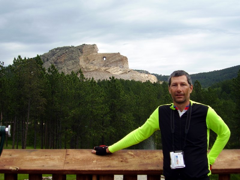
A group of us turned into the Crazy Horse monument area, and went through the museum and got lots of pictures. It was extremely interesting and humbling to see the work done by a crew made up mostly of the sculptor, Korczak Ziolkowski and eventually most of his 10 children. The work is progressing very slowly, since it is not federally funded. He put up with a lot of technical challenges in the early days, but now his family is carrying on with more advanced tools and techniques. He died in 1982, but the work goes on.
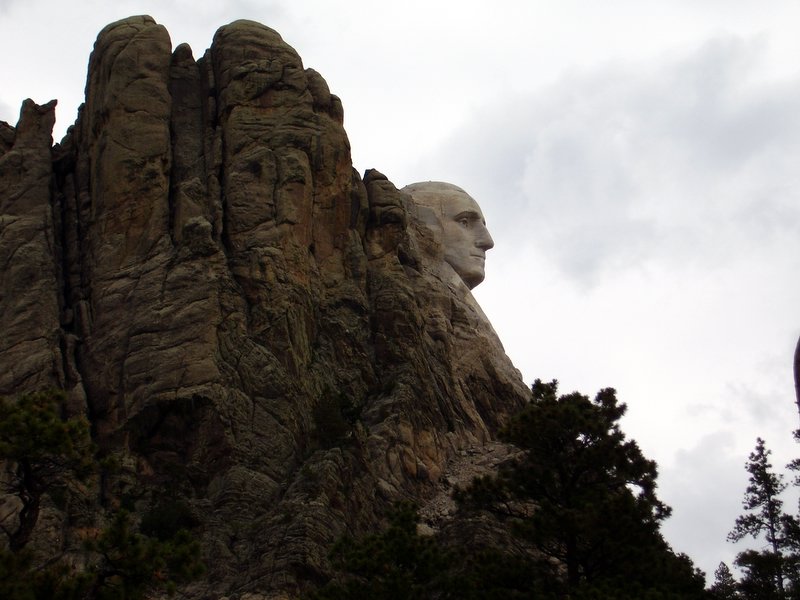
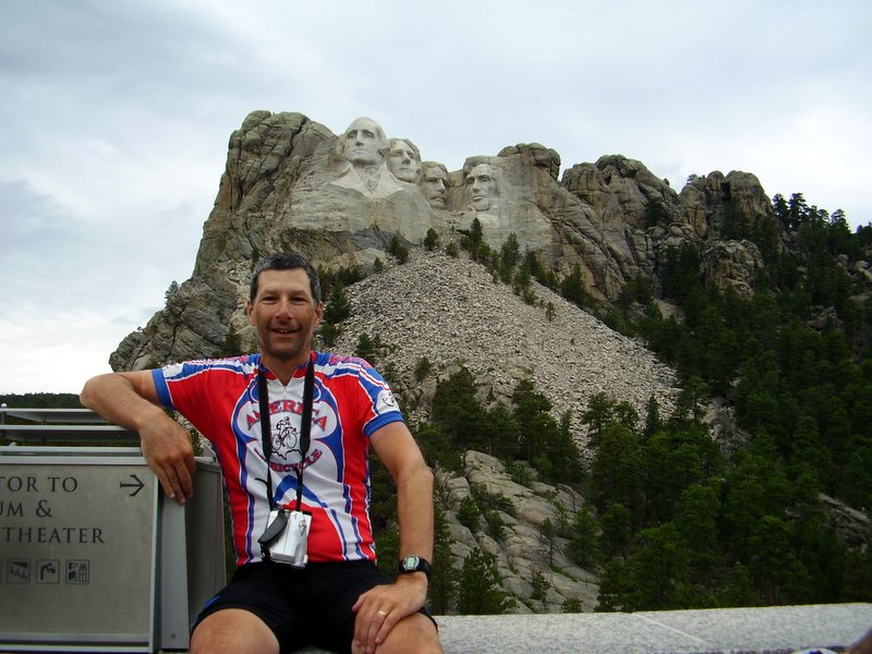
Then it was on to Mt Rushmore, a much smaller piece of sculpture if you can believe it. The approach is from the back of the mountain, and the route included some of the biggest climbs. The first sign is a pullout in the road where you can see George Washington's face in profile.
We got the other obligatory shots as well once we made it to the park proper.
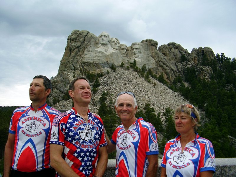
Pictured with me here are Dale Crockatt, Jeff and Julie Blake. Jeff was having too much fun, and didn't make a very serious Roosevelt.
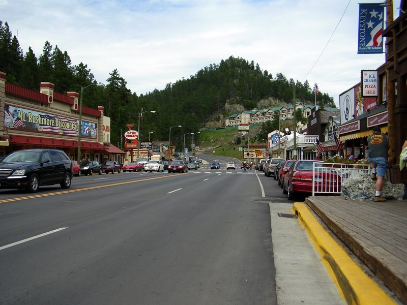
The second SAG was in the touristy town of Keystone. I ate in a local restaurant and had a buffalo burger and some delilcious rhubarb crisp with ice cream.
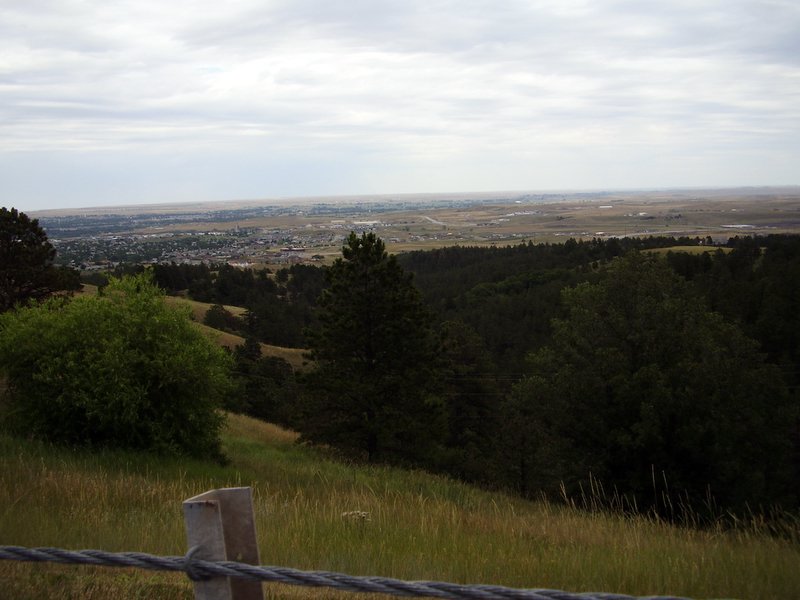
After lunch, I decided to finish the ride fairly quickly, and only stopped to get pictures of the plains, just visible on the horizon, and the town of Rapid City. Coming down from the hills to the plains was quite a rush. It was a great reward for all the climbing we had done.

I got in at 3:30, much later than usual, but still a good time for the amount of climbing and stopping for pictures. This was probably the most jam-packed day we have had, and what a place for it!
1 comment:
Ken's Dad lives in Bridgewater SD. Are you going to be on State Route 42 to Sioux Falls? This is Laura Ingalls Wilder country.
-Pagalag
Post a Comment